Drop a pin. See how that site connects to the grid.
GridFit is a grid connection screen for datacenter sites. From one location it maps the practical routes to the grid, gives an indicative time to power for each, and names the question to take to the utility. Tell us the MW and the date, and the answer is set against them.
No site yet? Ask where to look, and we return numbered search areas for your load. Own the land? A Screen shows what it can be powered for.
A map shows the grid. It does not show what the grid can power.
Most sites are chosen on land price and distance to a substation. The power date is discovered months later, after money has been spent. A Screen puts the grid question first, before the land is bought.
A nearby substation is not spare capacity.
Spare capacity is rarely published. A Screen says where it is unknown and separates what is mapped from what is confirmed.
The route sets the date.
Looping into a passing line, connecting at an existing substation and waiting for planned grid carry very different timelines.
Others want the same connection.
Datacenter campuses cluster. A Screen shows the datacenters already on record around the site.
One pin in. A short answer out.
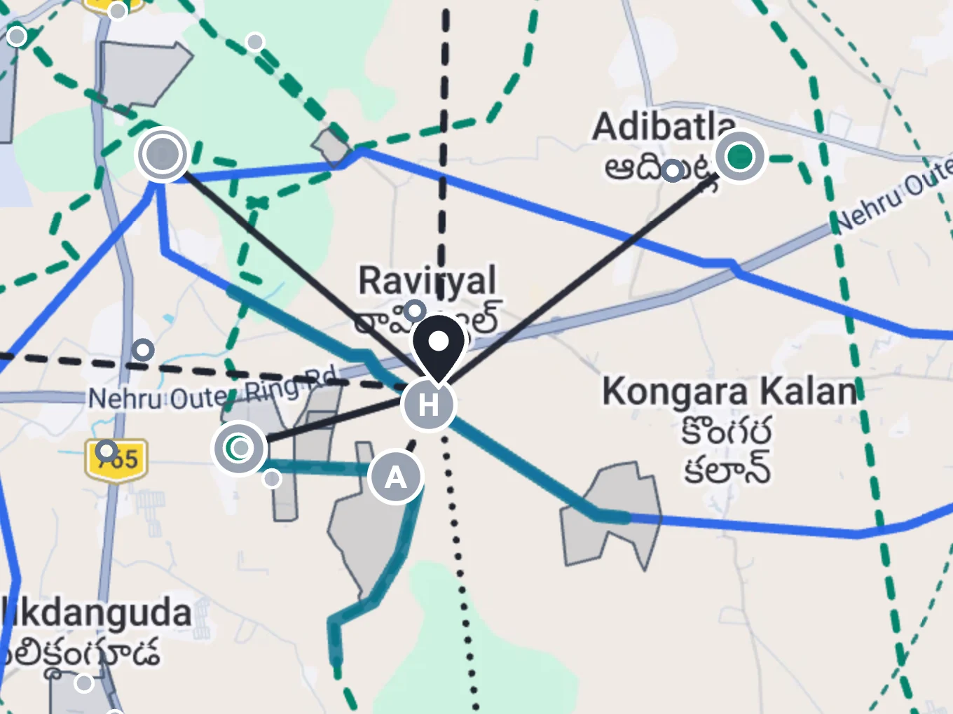
A Screen reads the grid around the pin and returns a report page with the map. Our datacenter site team reviews it before it reaches you, and every line names its source and its date.
Routes from the pin
Each practical route to the grid, lettered and drawn on the map, with its voltage and distance.
Indicative time to power
A month range for each route, set against your date when you give one.
Line cost band
An indicative cost range for the line on each route. Bays and your own substation come on top.
What feeds the substation
Where a nearby substation is fed from, and whether a published document flags loading there.
Datacenters nearby
Existing datacenters on record around the site, which depend on the same grid.
Two supplies
Which pair of routes could give the site two separate supplies.
The state rule
How that state treats the kind of connection each route needs.
The question to ask
The biggest unknown on the leading route, written as the question to put to the utility.
One site, a shortlist, or no site yet.
The same screen works at three scales. The map is a real GridFit view of Hyderabad. The charts are illustrative.
Screen one site.
Each route carries a month range. Give a date and the report shows which routes can meet it, and which one to pursue first.
Read the answer first.
Every Screen opens with a short answer. The best first route, a possible pair for two supplies and the biggest unknown, each with the question to ask.
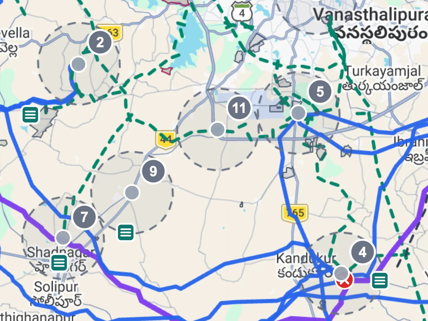
Search before you have a site.
With no site yet, GridFit numbers the areas around the substations that could serve the load. Land search starts where power may be possible.
Rank a shortlist.
Several pins compared for the same load and date. You see which sites are worth an Audit and which to set aside.
Search to find sites. Screen to choose one. Audit to decide on it.
A Screen guides the next check. It is not a connection offer.
A Screen is a desktop check. Distances are straight-line, time and cost are indicative ranges, and the utility confirms capacity, bays and dates. The topics listed here sit outside a Screen and are covered in the Audit.
See what the Audit covers- Land records and buildability
- MW fit and campus layout
- Water balance and cooling
- Approval matrix and durations
- Capex, NPV, IRR and payback
- GO / CAUTION / NO-GO decision signal
Send us a pin.
A location is enough to start. Add the MW and the date you need power, and the report is set against them. Most site reports come back within one working day.